In 2020, many of us newly appreciate the importance of local food systems, providing us with nutritious food in these hard times. Maintaining our local food systems on the arid Front Range will already be increasingly difficult due to the increasing extremes caused by climate change, and it will be impossible without irrigation.
Irrigable Acres in Boulder County
According to USDA data, at least 86% of Boulder County’s irrigable farmlands were lost between 1950 and 2017. Let’s preserve and protect the irrigable land we have left—both public and private—by making sure that prairie dogs can thrive elsewhere, in their designated Habitat Conservation Areas (HCAs).
Open Space and Mountain Parks (OSMP) irrigated agricultural lands comprise 6,640 acres of OSMP’s total 45,000 acres (reference, pg 39). The “Project Area” currently being debated only includes 2,400 acres of irrigated public lands, 967 of which were occupied by prairie dogs at the end of 2019 (reference, pg 33).
OSMP’s agricultural lands were purchased for many millions of dollars by Boulder taxpayers to remain farms, to produce local food for our community. They are not wild prairie ecosystems anymore. It is now absolutely clear that simply not killing prairie dogs does not return these fragmented parcels interspersed with development and highways to wild prairie ecosystems. These parcels were not wild when they were purchased to preserve as farmlands, and left untended and unirrigated they do not naturally “revert” to grassland wilderness; they actually become novel deserts, devoid of topsoil.
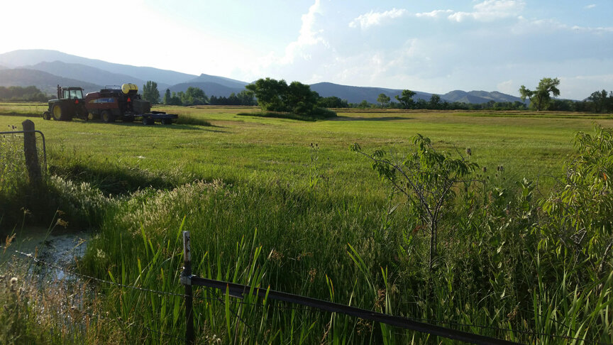
Tour Our Public Ag-Lands
HEAL volunteers are working with the community to create two new resources for tracking and improving the health of our public lands.
#1 — Take a Tour of Prairie Dog Impacts on Boulder’s public lands using Google Maps.
You can take the tour virtually (more photos coming soon!) or use the map on your phone to bike or drive the tour.
#2 — A Crowd-Sourced Open Database Tracking the Health of Boulder’s Public Lands
Below are just a few examples of OSMP-owned agricultural properties that have been significantly degraded due to the City’s current prairie dog management policies. (We will be adding new photos, data, and properties to this list over time.)
Without urgent intervention resulting from City Council’s August 11, 2020 policy decisions, some of these lands may be difficult or impossible to restore without hundreds of thousands of dollars of mitigation work and changes to prairie dog management policies recommended by the Open Space Board of Trustees (OSBT). These changes include allowances for lethal control and non-lethal burrow disturbance on agricultural lands to enable proven regenerative land management practices such as subsoil treatments, keyline plowing for water retention, and other techniques. Some of these lands are now in danger of losing their water rights because the soils are becoming so degraded that they can no longer be safely irrigated.
Explore OSMP Properties & Submit Your Own Data
Featured


Windstorm causing top soil loss on OSMP’s Cowles Property, July 2020

Below is a partial list of known properties in the 2020 “Project Area” that will be affected by City Council’s August 11, 2020 policy decisions.
According to the July 8, 2020 Open Space Board of Trustees Memo (reference, pg 33) the project area is generally north of Jay Road and west of the Longmont Diagonal. There are 2,400 acres of irrigated OSMP land within the area, which were acquired for the purpose of—and have been used for—agriculture. Of the 196 irrigated fields in this area, 135 currently have active prairie dog colonies on them due to past policies and practices. Approximately 967 acres of these irrigated agricultural fields were occupied by prairie dogs at the end of 2019. Most (526 acres) of this conflict is on OSMP lands previously identified in council-approved plans for the removal of prairie dogs. Land managers, including OSMP staff, have not been successful in managing the same parcels of land for irrigated agriculture and prairie dog populations simultaneously as these goals are incompatible and result in conflict and impacts to vegetation and soils.

(Below) A Map of Prairie Dog Colonies in Boulder Created by HEAL, Based On OSMP 2019 Data
